Showing posts with label Coastal Maine. Show all posts

Wednesday, August 28, 2013

Acadia National Park: Gorham Mountain Trail and The Bowl

Jack and I on top of Gorham Mountain
Tuesday I had tentative plans to climb Mt. Katahdin - which I have never done before.  It's a bucket list item that I hope to cross off next summer.  So with a day off from work and hiking plans fallen through, what was I to do?  Find another hike, of course!

I chose Acadia National Park because they are a dog-friendly park.  If I had followed through with Baxter State Park, I would not have been able to bring Jack with me.  When I got to Acadia, I was not sure what hike I would end up doing because they do not allow you to bring pets on every park trail.  A quick stop by the Visitor Center was all it took to figure out which hike to do.  The park officials were very helpful in answering my questions about the hike, how long it would typically take, and my dog's ability to complete the hike.  We settled on a loop that started at the foot of Gorham Mountain and traveled up and over the mountain with a quick hike up to The Bowl before heading back down to Sand Beach and the Ocean Path.  As I was coming back to the parking lot, I could hear people making comments like "I didn't realize dogs were allowed in the park."  Well yes, folks, they are!

There are some trails that you can take without actually going through the park gate, but this is not one of them.  Should you decide to try this hike, you will need to either pay a $20.00 access fee (good for 7 days access to the park) or you can pay a $40 access fee for a season pass if you plan on coming back again.  Both are available right at the park gate where they will also give you a complementary trail map.

To get to the beginning of the hike, take the Park Loop Road past Sand Beach and Thunder Hole.  The parking lot for this trail is clearly marked with signs.  In our case, the parking lot was full - but no worries!  A short drive past that parking lot there was another.  The loop that we hiked can be found here minus the quick hike up to The Bowl.  Without the added trip to The Bowl, the hike is approximately 3.5 miles at a moderate difficulty.  The trail is clearly marked with blue trail markings and cairns.

While it is a pet friendly hike, I'd like to make some recommendations when bringing your pet:

  • I would not recommend taking any smaller dogs on this hike.  Jack is a 75lb dog, and he could easily navigate the climbing that was required.  I would not be surprised if any smaller dogs would need to be carried over part of the trails.
  • Be sure to bring appropriate supplies including baggies to clean up after your pet, water/water bowl for your pet, and snacks for your pet.  Like any human hiker, dogs have needs, too!
  • Do NOT bring your pet on this hike unless they are very good on a leash.  The trail can be very steep in places.  No hiker wants to tumble on their descent when their dog decides to pull on it's leash.
  • Do NOT bring your pet on this hike if they are not good around other people and/or dogs.  This is a popular hiking trail for families with small children and pets.
  • I would highly recommend alerting any hikers you may come upon with children of your presence before you get close.  No matter how friendly your dog is, some children have a fear of large dogs.  A simple "Is your son/daughter okay with dogs?" is much appreciated and gives you and other hikers a chance to scoot around each other in a comfortable manner.
Now - back to my hike! :)  This is the one photo that I got on my hike that day.  Unfortunately when I got to the actual summit of the mountain (about 525 feet), I was holding my phone in the same hand as Jack's leash when he decided to pull on it.  A < 3 foot drop later, and my phone was toast.  The photo above is courtesy of a very nice family that I met from NY.

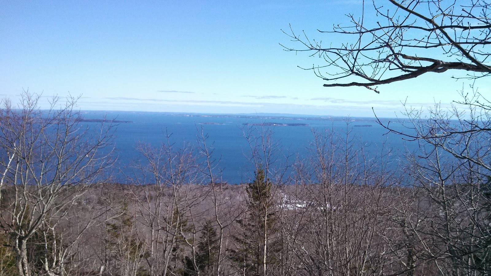
From the Gorham Mountain Trail.


I took this at a little turn out just before reaching the summit where Jack and I stopped for a water break.  In the left of the picture you can see the coast over near Sand Beach.  There are spectacular views from this mountain, and I am very sad to have not gotten the opportunity to capture them.  But that gives me a reason to hike it again!

There were many people of all ages on the trail that day, and Jack and I stopped for a chat with quite a few families.  The family that took our photo at the top actually hiked most of the rest of the way down the mountain with us, and the little girl probably would have taken Jack home with her if she could! haha  We said goodbye at the start of The Bowl trail, as they were headed on their way directly to Sand Beach.

The Bowl is not a very long or difficult hike.  A map of the trail can be found here (minus The Beehive portion).  The "Advanced" difficulty rating you see when following the link is specifically for The Beehive which takes you up a cliff face with iron rungs set in to help you climb.  Jack's lack of opposable thumbs took that off our itinerary for the day ;)  I was surprised to find that The Bowl trail was made up of mostly steps that were set into the trail.  It was quite the flight of stairs to climb, but the view at the top was worth every one of them.
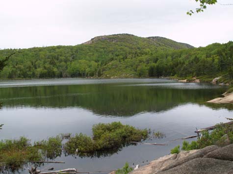
Looking across The Bowl.
Acadia National Park permits swimming only in certain areas of the park.  Lucky for us, The Bowl is one of them.  This is what makes it such a popular spot on a hot day.  Sand Beach is very busy during the summer months, as everyone wants to swim in the ocean.  While there were people here swimming yesterday, it was not over crowded.  As soon as Jack saw the water he was very anxious to jump in and cool off.  We made sure to make our way around to an area of the pond where there were no swimmers.  While the park has restrictions on taking your pet off a leash, I did sneak in a few minutes of free time for Jack to get a swim.  We spent 10-15 minutes just playing fetch in the pond before turning back to the trail to make our way down to Sand Beach.

The hike back down to Sand Beach seemed to take no time at all.  There were some very rocky areas on the trail, but it was fairly easy going.  Once we reached the Park Loop Road, the Ocean Path was like a stroll in the park - literally.  The Ocean Path is just what it sounds like.  It's a dirt pathway that takes you along the ocean between the shore and the Park Loop Road.  We walked by Sand Beach and Thunder Hole on our way back and stopped to talk with several people along the way.  Something about having a dog makes everyone want to be your friend, or so it seemed.

The entire hike took us 4 hours or less.  I was timing our hiking time on my phone, but we all know what happened there!  Jack was tired enough when we reached the Jeep that he took some coaxing to get him to jump in the vehicle.  I think he had a good time making new friends, getting some exercise, and swimming in a new pond, though :)

For more information on park trails, where you can swim, and where you can take your pets - please visit the Acadia National Park website at http://www.nps.gov/acad/index.htm.

Follow my blog with Bloglovin

Monday, August 26, 2013

Lobster SUP Cup 2013

I'm a little late getting this entry in, but better late than never!  Two weeks ago I had the pleasure of being a volunteer for the inaugural Lobster SUP Cup.  If you haven't read my previous post about Stand Up Paddleboarding, you can find it here.  SUP is relatively new to Maine, and while constantly growing in popularity - it's still relatively unknown to most people who live here.  It seems every time I am out on Brewer Lake I will get questions about "What do you call this?", "Where can I get one?", and a range of other questions about the difficulty of the sport, what I like about it, etc.  As such, Maine hasn't developed much in the area of competitive SUP racing.  Until now...

Thorfinn Expeditions hosted the first SUP race here in Maine with their 2013 Lobster SUP Cup.  The race spanned two days and covered 25 miles of Maine's rugged coast line.  Being that I just picked up the sport this year for exercise more than as a serious racer - I only attended as a volunteer this year.  My best friend, however, did race.  That's right.... she's a super star!  She just picked up the sport in May, and already has done a long distance race.  Here she is at the start of the SUP Cup in Rockport Harbor:

Our trip started the day before the race, as we wanted to make sure to be there with plenty of time to help out in any way necessary.  All of the SUP racers and volunteers were very friendly and in no time at all we felt like we had always been part of this group.  We filled out all of our paperwork, and then were left with the rest of our Friday night to just chill in the Lincolnville area.  Saturday morning would be when all of the festivities/race would start.

Saturday morning's race began in Rockport Harbor and traveled to Lincolnville Beach with a detour into Camden Harbor.  I spent my morning helping load up the boats while Sarah and the other racers prepped for start time.  Typically I consider myself to be a fairly athletic looking person, but looking around at the athletes in this race I no longer felt that way.  These people were in some serious shape - which is a testament to exactly how great a workout SUP can be.  This race had drawn people from as far down the coast as NC and even a former Olympic gold medalist from Canada named Larry Cain.  You can find his blog post about the race here - his post is probably much better.... he does this for a living, so cut me some slack!

While everyone else was going to spend their day on a board, I got the opportunity to spend my day on a boat taking photos of all of their hard work.  Jared Cumming's boat The Osprey was the place to be if you were a volunteer.  I'm always amazed at how openly welcoming people are in Maine whether they grew up here or have come from away.  The volunteers on The Osprey were no different.  All of the volunteers were so much fun to spend the day with, and Jared was a very gracious host.  This race featured some spectacular scenery along the Maine coast, and it was a pleasure volunteering to photograph it all.  Some of my favorite shots were as the racers passed the lighthouse coming out of Rockport Harbor, shots as the racers came through Camden Harbor, and catching video of the start of the race.

Lighthouse coming out of Rockport Harbor.
Marta Downing coming through Camden Harbor.

As the racers came through Camden Harbor, there were plenty of spectators all cheering them on.  From there they traveled up the coast to finish in Lincolnville Beach where they were rewarded with an after party at McGlaughlin's Lobster Shack.  There they had their choice of a lobster dinner (not one, but TWO lobsters), fried seafood platter, and BBQ chicken.  The food here was amazing, and the atmosphere was on par with the food.  It was great to be able to spend some time with the SUP racers, share some of the day's photos, and make some connections for some future races.  As part of the after party, awards were given out to the top 3 male racers and top 3 female racers.  

Day Two of the Lobster SUP Cup started in Lincolnville Beach with a finish line in Belfast.  Rather than start from the water as they had in Rockport Harbor - the racers were doing an actual beach start.  Unfortunately given the nature of the start, I could not get some video of this one.  I did get to spend the day on the water again, though.  I'm constantly amazed at the things that are available to people right here in Maine.  There is so much to experience if people just seek it out.  Being out on the ocean for the day was no different.  Everything from the scenery to the people - could not have planned a better weekend on the coast.

Since I was on a chase boat rather than the photography boat, I did not get quite the same photos on the second day of the race.  With my camera it always seemed that the SUP racers tended to get lost in the rock face they were paddling by - but here's a peek at part of their trip that day.
I think that my favorite part of day two was following the last racer's trek towards Belfast.  She showed such perseverance and determination that it was inspiring.  Inspiring enough for me to agree to do a smaller race (only 5 miles) in Cape Cod later next month. :)  Here's my absolute favorite shot of the day - her crossing the finish line while everyone cheered her on from shore.  I wish the angle had been better so I could have gotten everyone else in the background - such a supportive group!

This day the after party was in Belfast, and we all headed for Rollie's.  Rollie's is such a great little bar - the beer selection had something for everyone and the food was awesome.  We spent a good bit of time there refueling before heading to the unofficial after party place - Three Tides.  I can't think of a better place to have had the after party.  This is an eccentric bar/restaurant that didn't disappoint.  They even have bocce ball set up for their patrons.  Being that we were in a competitive crowd, it didn't take long for us to make use of that.  The evening ended with all of us exchanging contact information and making tentative plans to meet up at future races. All in all, it was an amazing weekend with some really great people!

Saying goodbye at Three Tides.
For more photos of the race, find me on Facebook or visit the Lobster SUP Cup Facebook page.
 

Monday, June 3, 2013

Monhegan Island, ME

A few years ago I purchased a book filled with recommended hikes, kayak trips, and mountain biking trails in Maine.  One of the entries in the book was for hiking at a place called Monhegan Island.  I was immediately interested in making the trip out to this remote island to hike the cliffs and see a bit of the island life.  It took a few years for me to finally plan the trip, but this past weekend we made it out to the island to do some hiking and see what we could see.

Sunset on Monhegan
Monhegan Island is a small island about 1.7 miles long and 0.7 miles wide that is about 10 miles off the coast of Maine.  The only way to get there is by boat either on the Monhegan Boat Line, Hardy Boat Cruises, or Balmy Days Cruises.  We chose to take the Monhegan Boat Line out of Port Clyde, ME.  The boat is a no-frills way to get to the island, but it was nice to sit in the very front of the boat out on the deck and watch the islands go by during the one hour trip out to Monhegan Island.

Lighthouse at Port Clyde
Coming into the harbor you can see the smaller island of Manana which shelters the harbor from the harsh weather this far off the coast.  The smaller island is uninhabited.  It's last resident was a hermit and his herd of goats, but he passed away in 1975.  A film was made about his life called The Hermit of Manana.  There is still a herd of goats on the island, but not much else.  For a brief period there was a manned Coast Guard station there, but that has since been automated.  While the small island has no residents, you can make a day trip over to explore during your stay on Monhegan.  Just go to Swim Beach and ask/radio for Rusty who will take you across in his small boat.  We did not make the trek over, but I hope to go back someday to see it.
Manana on the boat ride to Monhegan
Closer view of Manana

Our first experience when getting off the boat was seeing The Barnacle right off the dock.  The Barnacle is a bakery and coffee shop that sells fresh made pastries, chowder, coffee, tea, etc.  The food is made at the Island Inn and then brought down to be sold at the store.  If you happen by The Barnacle, I highly recommend the raspberry croissant or the strawberry rhubarb muffins.

The Barnacle at Monhegan Island
Walking up the hill towards the village there is the Island Inn on your right.  This Inn has an amazing view of the harbor and holds 32 rooms and suites.  While we did not stay at the Island Inn, we did go there for supper on our last night on Monhegan - it was amazing.  I had a Curry Squash soup for an appetizer, Filet with lobster and white wine risotto for main, and then topped it off with a Blackberry Rhubarb Crisp ala mode.  A heads up to those that enjoy beer/wine with their meals - it is illegal on the island to serve alcohol.  You can buy alcohol at The Cantina, The Barnacle, or The Novelty and bring it to dinner, but they cannot serve you alcohol anywhere on the island.  Expect the prices at the Island Inn to be a bit more expensive than the rest of the island, but the food there was very good.  I also found the bulletin board with an FAQ sheet about the Inn to be quite interesting.  Tidbits such as how they get electricity on the island (3 large diesel generators power the whole island costing $0.70/kwh) and that they have to pay $10.00/bag just to send trash off the island.  It really put things in perspective when you think about how many people live on the mainland.

Across from the Island Inn is another place that offers accommodations to visitors to the island - the John Sterling Harbor House.  The Harbor House has no restaurant, and we did not stay there so I cannot speak much to the characteristics of the accomodations - but I thought it worth a mention.

Continuing up the hill there is a small craft store called Winter Works that we found very interesting.  Many people on the island do crafts during the winter to sell to tourists in the summer (hence the name Winter Works).  They assembled a craft co-op of sorts, and there were all kinds of interesting things to be found there.  Crafts made with sea glass or shells, painted ornaments, or even knitted items.  The woman who was working here was very friendly and open to questions about the island.  She is a full-time resident of the island, and she has lived there 20 years.  There are 40-50 full-time residents on the island, and they even have a one room school house which currently has one second grade student and two kindergarten students who attend half days.  The island residents are working hard to encourage young families to move out to the island, as the population has been declining as people move the less remote mainland.  Even though the island is remote, it still has things like high speed internet and a cell phone tower - some of the residents have telecommuting jobs where they spend the majority of their time working from the island with occasional infrequent trips to the mainland.

The island seems to attract many artists that wish to paint the coast landscapes, wildlife, and the small village itself.  This artwork can be found on display and for sale in many galleries across the island.  Most shops (and The Rope Shed) have a map of where the galleries can be found.  Another essential item if you plan on hiking while you are there is a Trail Map.  They can be purchased for $1.00 at either the Lupine Gallery or the Cantina (the island's only grocery store).

Taking a right at the end of the road, we headed by the Cantina (here you can buy groceries and find the Island's only ATM) and then Swim Beach.  Swim Beach is really the only safe place on the island to go swimming.  Much of the island's shoreline is very rocky with high cliffs and unpredictable waters.  Swimming anywhere other than Swim Beach is not a good idea - and after hiking the entire perimeter of the island, I can see why.  They have had people lost, swept out to see as late as 2011.  There is no emergency service on the island (not even a police force).  Swim Beach is also where you will find Rusty, who will take you over to  Manana for the day should you wish to explore the smaller island.

Just past Swim Beach you will find the "Rope Shed".  This is the go to place for all announcements, information, and events on the island.  It acts as a community bulletin board where you will see postings for everything from cleaning services to jambories to gallery events.  If you want to know what is going on on the island during your stay, take a peak at the Rope Shed on your way by.

Just past the Rope Shed is Fish Beach where you will find The Fish House.  The Fish House was not open during our stay, sadly, but it has great reviews on Trip Advisor and from word of mouth if you are in the market for some local seafood.  They are a take-out place, and as such they are a cheaper option than the Island Inn should you want to sample the local catch of the day.

Beyond Fish Beach you begin to get into the Village center.  There is a small Post Office, The Black Duck Emporium (gift shop), the island's only church, and The Monhegan House.  The Monhegan House is where we stopped for dinner on our first night on the island.  Their prices were much more reasonable than the Island Inn, and honestly - the food was a notch above.  We had Parsnip/Leek/Ginger Soup for starter, and I tried the Atlantic Trout for a main.  Both were amazing.  I will say that were I to recommend the ideal place for a sit down meal on the island, this would be it.  The staff were very courteous and the atmosphere was very laid back.  They also have a sandwich/pizza shop at the back of the Monhegan House called The Novelty.  We tried the pizza there one afternoon for lunch, and it was possibly the best pizza I've ever had.  It was also funny to meet the man working behind the counter and find out he was from The County not far from where we grew up.  Like many of the people we met on the island, he was a summer resident working just for the season.

Past the novelty the road inclines sharply, and in our case that meant carrying our bags up the hill to get to The Hitchcock House where we were staying.  In my opinion, if you are coming to the island for a weekend and just looking for the experience - no bells and whistles - this is the ideal place to stay.  We stayed in a room called "The Yellow Room" which had two twin beds and a semi-private bath.  It was just $85.00 a night, and that was very reasonable for the accommodations.  We had access to a large deck, patio furniture, and a propane grill.  The room was very comfortable, clean, and quiet - also being that it was on the top of the hill - the breeze kept it cooler than it was down near the harbor.  Barbara Hitchcock owns The Hitchcock House and The Black Duck Emporium.  She was very friendly, informative, and made us feel right at home on the island.

The Yellow Room at The Hitchcock House
We had taken the last boat out to Monhegan, so our first night there was spent just looking around the village, having supper, and then watching the sunset - which was gorgeous over Manana.  But the next day we decided to start out early and hike around the Island.

**An advisement to all hikers on these trails - they are not very well marked (take a trail map with you everywhere) and the terrain off the trails is very rough, so stay on the trail.  If you go off the trail to do something like watch the seals in the harbor from the rocks - make sure to come back to the trail before you continue on.  Bring a good pair of hiking boots, as well.  We packed light and brought sneakers rather than boots - learn from our mistake!  We are both very fit and sure-footed but with just sneakers it is still very easy to lose your footing on some of the rocky terrain.

The first half of our day took us to the northern side of the island.  We spent the morning climbing over rocks and watching the wildlife near shore, stopped to take photos of a local lobster boat setting it's traps for the day, and then stopped for a mid morning snack on a cliff overlooking the water.
Lobster boat setting it's traps
Seals playing off shore
Unlike many other hiking trails in Maine, these trails are not very well traveled (at least at this time of year).  So be sure to hike with someone in case of emergency, as there is slim chance of meeting anyone else on the trails.  Our trip around the island brought us to a trail that wound right back to The Hitchcock House where we re-stocked on water and walked to The Novelty for lunch.  From there we chose to explore the other side of the island at Lobster Cove where there was a ship wreck (an old tug boat that had crashed up on the rocks during a storm) and more cliffs to climb.  By early afternoon we had made our way around the entire perimeter of the island and gotten some great photos along the way.  It left us just enough time to clean up and head to the Island Inn for dinner.
Ship wreck at Lobster Cove


We had a relaxing day the next day waiting for our boat to leave at 12:30, and I couldn't help but think about how peaceful and easy-going life on the island seemed during the summer.  I'm sure it's much more harsh during the winter given the remoteness of the island, but for right then - the idea of living somewhere where you had to be as self sufficient as possible.... it just seemed like that is how we are meant to live.  Not a slave to the endless rat race trying to get ahead of the person next to you - but as a community living, working, thriving together.  Taking the boat back to the mainland it felt almost like traveling to another world - even now being home it hasn't really sunk in yet.  This little island just 10 miles from Port Clyde but worlds away in terms of quality of life.

If you live in Maine or are just visiting - whether you can spare a day or a week - Monhegan Island should be on your list of places to see.  It is one of those places in Maine that will show you why they say "Maine - The way life should be."

View from the cliffs hiking around Monhegan

Looking over one of the cliffs at Monhegan

Wednesday, March 6, 2013

Stand Up Paddle Boarding

Last year I traveled to Las Vegas, NV in April to visit some friends, and while I was there I tried something called Stand Up Paddleboarding (SUP for short).  I know - not your typical Vegas activity, but I'm more of an outdoorsy person than a gambler. :)  I had never even heard of SUP before, but a friend I was visiting had tried it and thought I would enjoy it.  So off we headed to Lake Las Vegas for a day on the water.  We spent several hours on SUPs around the lake - by the time we came back to shore I was hooked and determined to give it a try back in Maine.

If this is the first you've heard of SUP, you're probably wondering what exactly it is.  SUP originated in Hawaii, but it has rapidly spread in popularity in recent years.  A SUP is very similar to a surf board, and can be geared towards racing or recreation, oceans or lakes - just like kayaks, there are a wide range of boards to choose from depending on how you plan on using them.  They make boards that are built to carry gear (usually with bungee cords at the front of the board), and others have room for you to have a child sit on the board with you on your tour around the lake.  Or if you're like me - maybe you will try taking your dog out on the water with you.  I'm not sure how well Jack will take to sitting still, but we're going to give it a try!

After spending much of my summer last year playing ball, I was determined to pick up a SUP in the off season and get out on the lakes and ocean this coming season.  If you are interested in trying SUP, I recommend finding a place locally that does tours and lessons before investing in a board.  Buying a board and paddle new can be quite expensive - costing you well over $1,000.00.  Two places locally that provide SUP tours are Acadia Stand Up Paddle Boarding in Bar Harbor, ME and Thorfinn Expeditions in Lincolnville, ME.  They both offer a wide range of SUP tours, and in Bar Harbor they even offer Yoga sessions on the SUPs.

Personally I have tried neither of these companies, but I did purchase my SUP used from the owner of Acadia SUP.  Chris was very helpful when it came to answering questions that I had about the fit of a board, what size board I would need, etc - and information on when they would begin lessons should I want to get out on the ocean early.  If you are a beginner, I highly recommend purchasing your board from someone that knows a lot about the sport - and purchasing it used.  The board I ended up buying was used for only one season on the ocean in Acadia, and it still cost me over $800 for both paddle and board.  So if you decide to invest in your own board/paddle - you want to make sure you talk to an expert.

I have no experience with Thorfinn Expeditions to speak of.  But I will say this - Chris had great things to say about Thorfinn Expeditions should you find yourself in the Lincolnville area rather than Bar Harbor.

While SUP is a great way to explore in Maine, it is also a great workout.  If your paddling technique is correct, you will be using mostly your core muscles.  This was also something that made SUP have a lot more appeal for me because really - does anyone actually like their ab workout?  I'd rather paddle around the lake than do crunches any day!  In looking at the photos on Acadia SUP's website, the yoga sessions look like a lot of fun, as well.  I would go into it expecting to end up in the water, though.  I'm not great at yoga on dry land, and I cannot imagine how poorly I'd perform with the board moving underneath me.

Hopefully this post has piqued your interest enough to make you consider SUP this summer should you find yourself on the coast of Maine.  Who knows - maybe Jack and I will run into you on the lake!


Monday, February 25, 2013

Camden Hills State Park

I know it's been quite a while since I've posted in this blog - I haven't been hiking as much the last couple years, but that is something that will be changing this summer :)  Or sooner....

Camden Hills State Park

Friday afternoon was in the mid-upper 30s, so I logged off work a little early and headed for Camden.  Initially I thought I would need my snowshoes for this hike, but when I got there the snow was already packed so well that I ended up hiking it without them.  The park is dog-friendly, so I took my chocolate lab, Jack, along for the hike.  Surprisingly it was just the two of us in the woods that day.  There is a feeling of calm in the woods during winter that isn't there on the same level during other seasons.  It was just what I needed.

Park Info - There are several park entrances that you can take, but I typically use the entrance on Rte 1 just before getting into the town of Camden.  The day use fee for the park is $3.00.  You can find more information about the park at the State of Maine's website here, and you can find a brochure with information published by the park here.

We ended up taking the trail up to Ocean Lookout (elev. 1300ft) to take in the views of the coast.  Usually I take my Olympus with me, but I ended up with only my phone to take pictures with.  They just don't do the view justice, but here are some photos from that day.  If you live anywhere near Camden Hills State Park, be sure to check it out sometime.  Any time of the year, I'm sure it is breath-taking.  I can't wait to hike it in the fall when the leaves are in full color.

Jack on the trail in the woods.

There was a fair amount of snow, but it was easy going without snowshoes.

View from the trail - wish I had my camera not just a phone! :)

View towards Camden.

Jack checking out the woods.

Another view of the ocean.

Taking a break.

Yes...I bribed him with a treat for this photo lol


Stopped to make some snow angels.  Couldn't help it - I'm a big kid.

Jack - tired after the hike.


Tuesday, March 23, 2010

The Bold Coast - Cutler Preserve

This hike caught my eye because it travels along 100ft cliffs on the coast, and it would be easy to make a full day of this hiking trip. According to what I've read, the 5.8-9.8 mile loop (depends on the route you take) includes barrens, bogs, maritime forests, and a completely exposed hike along the coastal cliffs. In late summer and early fall, whales can sometimes be seen passing through the Grand Manan Channel on this hike. This really makes me want to wait until late August or September to make this hike, as it would make the trip just that much more awesome to get to see the whales from the cliffs.

Evan's Notch - Blueberry Mountain Loop
This is a moderate 4.5 mile loop hike in the Maine portion of White Mountain National Forest. It is said that it is a particularly beautiful hike during the fall when the foliage begins to change. The hike includes a small gorge known as Rattlesnake Flume, and a popular swimming hole known as Rattlesnake Pool. Although the names do not sound very inviting, be assured - there are no poisonous snakes in Maine :)


Evan's Notch - The Roost
I was thinking it would be a good idea to go on a weekend trip and combine the climb up the Blueberry Mountain Loop with the climb up The Roost. This is a shorter hike of about 1.2 miles that brings you to a view of the Wild River Valley with views of Grafton Notch and Mahoosuc Range. A weekend trip when the foliage changes would make for some spectacular photos!


Mahoosuc Notch
This 6.5 mile round trip hike is considered a difficult hike and has been referred to as "The hardest mile on the Appalachian Trail". This hike includes climbs over boulders and through caverns as you make you way through the notch. Hikers need to pay careful attention to their footing (especially when the terrain is wet) as the terrain is very uneven. What caught my eye about this hike were the massive rock formations on the trail that were created when the glaciers receded from the area during the last ice age (see photo).


Mount Kineo
This is a kayak/hiking trip on Moosehead Lake (the largets lake within one state east of the Mississippi). The hike itself is only about 4 miles round trip, but the only way to the mountain is by water. It is on an island in the middle of Moosehead Lake. You can either paddle across yourself from Rockwood or be ferried over by the Kineo Boat Launch which departs from 8am to 5pm on the hour. If you do not have your own kayak, rentals are available right in Greenville. Not only does this climb boast 800ft cliffs, but once you reach the top of Mount Kineo, there is a restored look-out tower which offers a 360 degree view of Moosehead Lake. Henry David Thoreau made two trips to Mount Kineo and had this to write about it - "The celebrated precipice is so high and perpendicular that you can jump from the top, many hundred feet, into the water which makes up behind the point. A man on board told us that an anchor had been sunk ninety fathoms at its base before reaching bottom! Probably it will be discovered erelong that some Indian maiden jumped off it for love once, for true love never could have found a path more to its mind." This is now one of the trips I am most excited for.

Gulf Hagas
This is probably the one trip that I have been waiting all winter to be able to make. I first heard about the "Grand Canyon of the East" from my soccer coach at University, but at the time I was so caught up in other things that I did not pay it much mind. This winter, it suddenly came back to me, and I started doing research. Gulf Hagas is near Brownville Junction in the 100-mile Wilderness (the most remote section of the Appalachian Trail), and once this wild landscape was also home to Katahdin Ironworks. Iron ore was mined from nearby Ore Mountain and brought here to be turned into pig iron. The iron works succumbed to outside competition and closed in 1890, but you can still see remnants of the blast furnaces used to super heat the ore. The 8 mile loop hike is considered moderate to difficult, and includes side trips to many waterfalls and pools. A site referred to as "The Hermitage" is home to a stand of old growth white pines (see photo).

South Turner Mountain/Sandy Stream Pond
This hike is considered by many to be a great introductory hike to Baxter State Park. It is located at the South Enterance, and it is a good idea to come early because when the parking lot is full - there are no more hikers allowed on the mountain. While South Turner offers a great view of Katahdin, it is from the Millinocket side - and the best view (by a long shot) can be found from the other side of the mountain (try the North Traveller hike for this one). I will say that it is the view that has caught my eye for this hike, though. It offers great views of Russel Pond, Whidden Pond, Basin Ponds, and Little North, South and Great basins of Katahdin. It is a moderate 5.5 mile hike where a camera is a must have.